Tea Country Hiking Trail The Pekoe Trail
Sri Lanka’s Tea Country Hiking Trail –
THE PEKOE TRAIL
The Pekoe Trail by Sri Lanka Trekking Club
The pekoe trail Views and brews: what it’s like to hike the hills of Sri Lanka’s tea country A new walking trail takes visitors through the heart of tea estates and hill country.
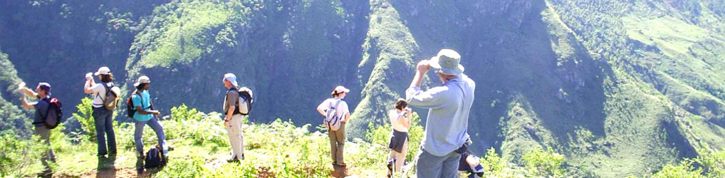
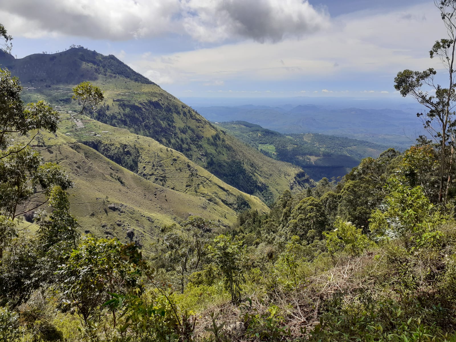
Sri Lanka, with its historic tea estates, glorious mountains, tropical rainforest, and bird-filled jungles, is a hiker’s dream. There is an endless array of trails to follow ranging from gentle walks to multi-day treks, so whatever your age and physical ability you can enjoy unforgettable walks on a Sri Lanka holiday. However, for those lusting after a serious hike, look no further than these extreme expeditions in Sri Lanka.
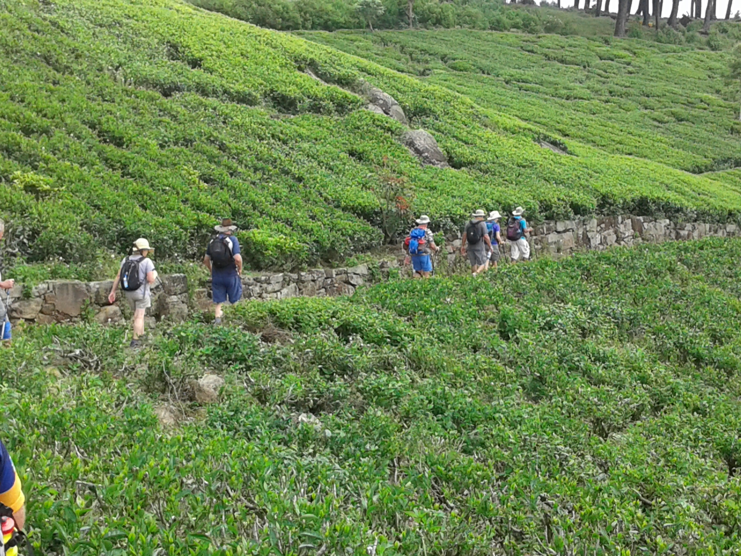

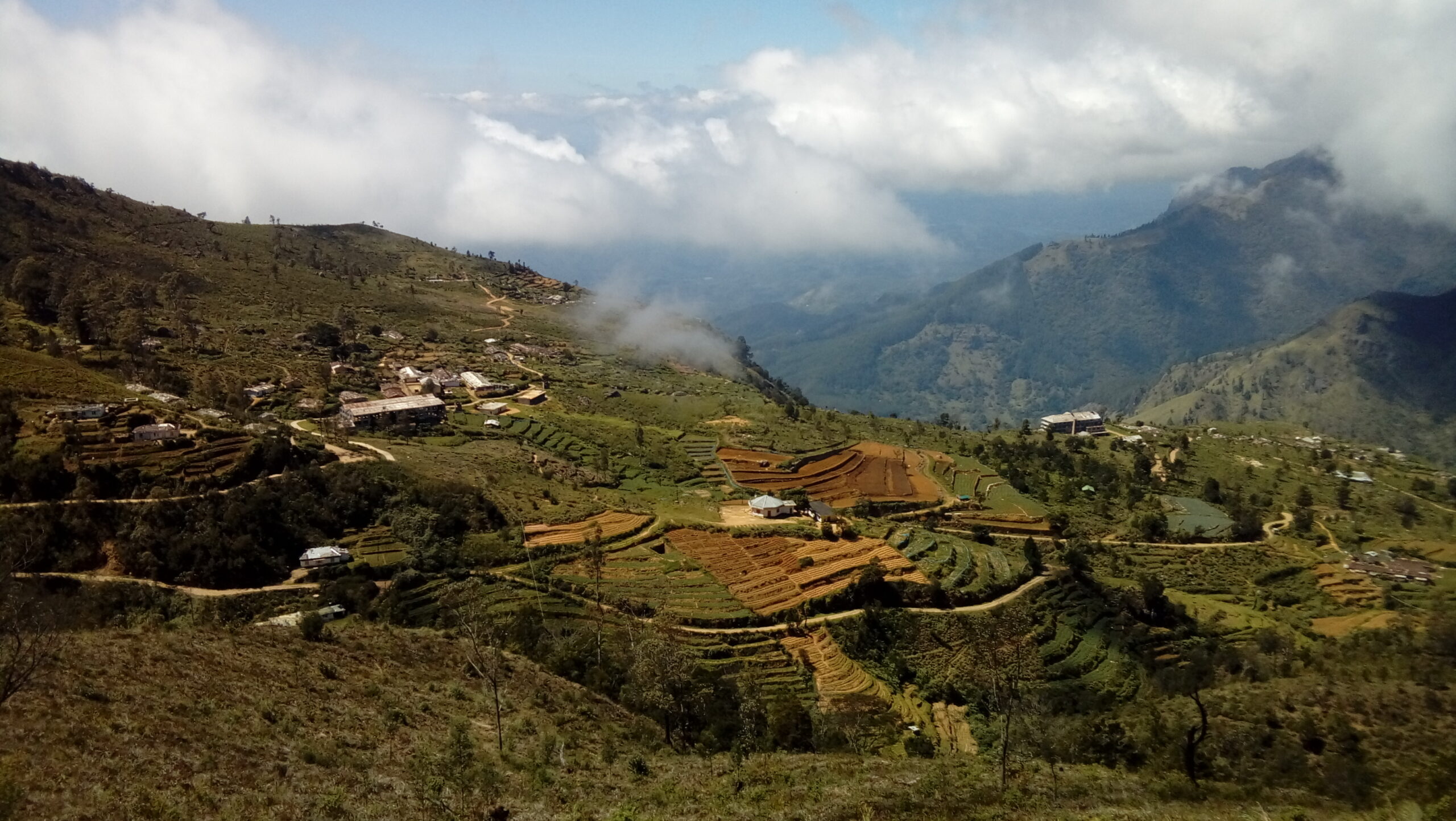
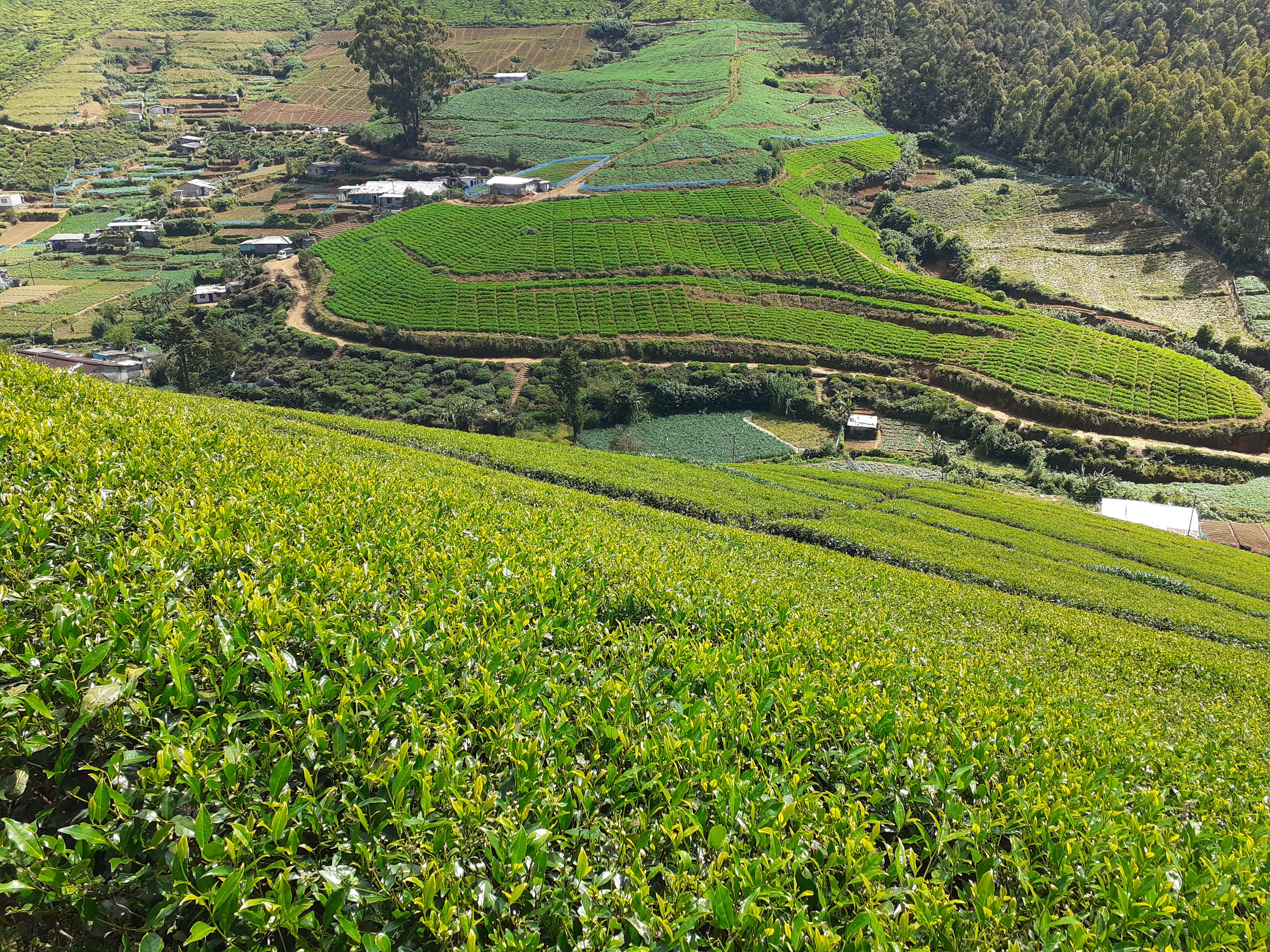
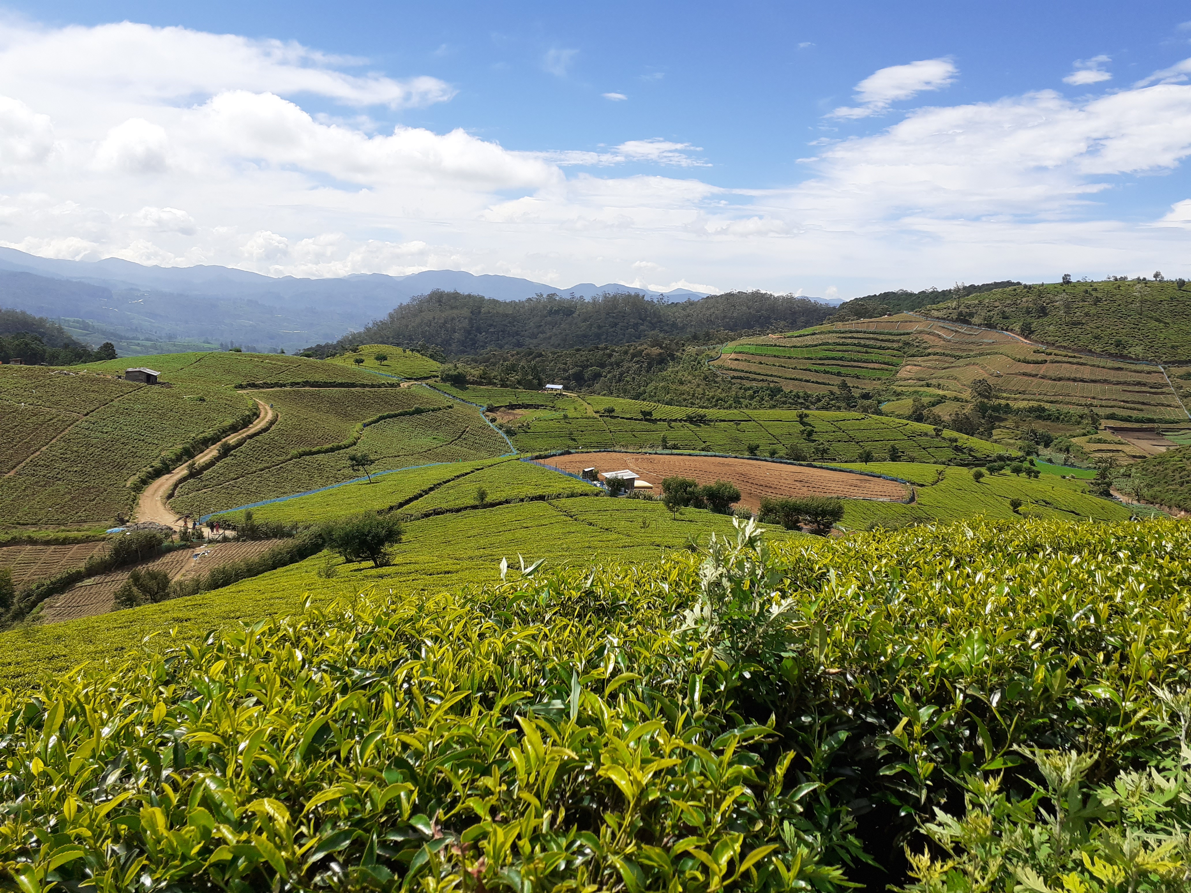
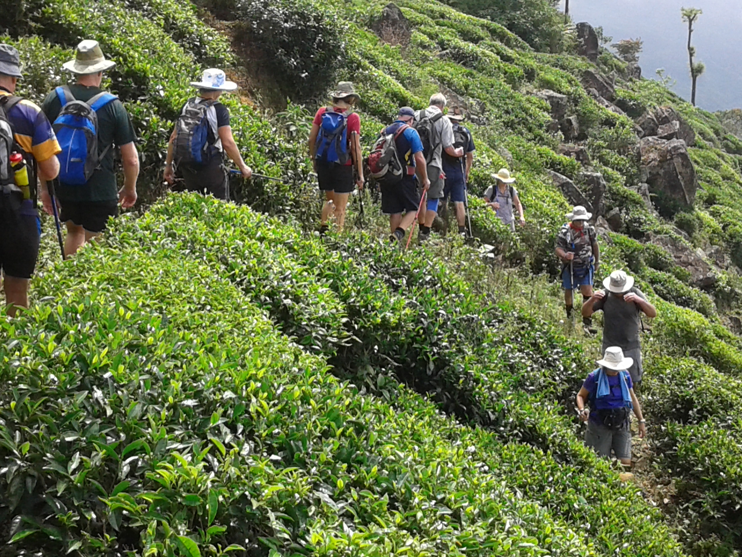
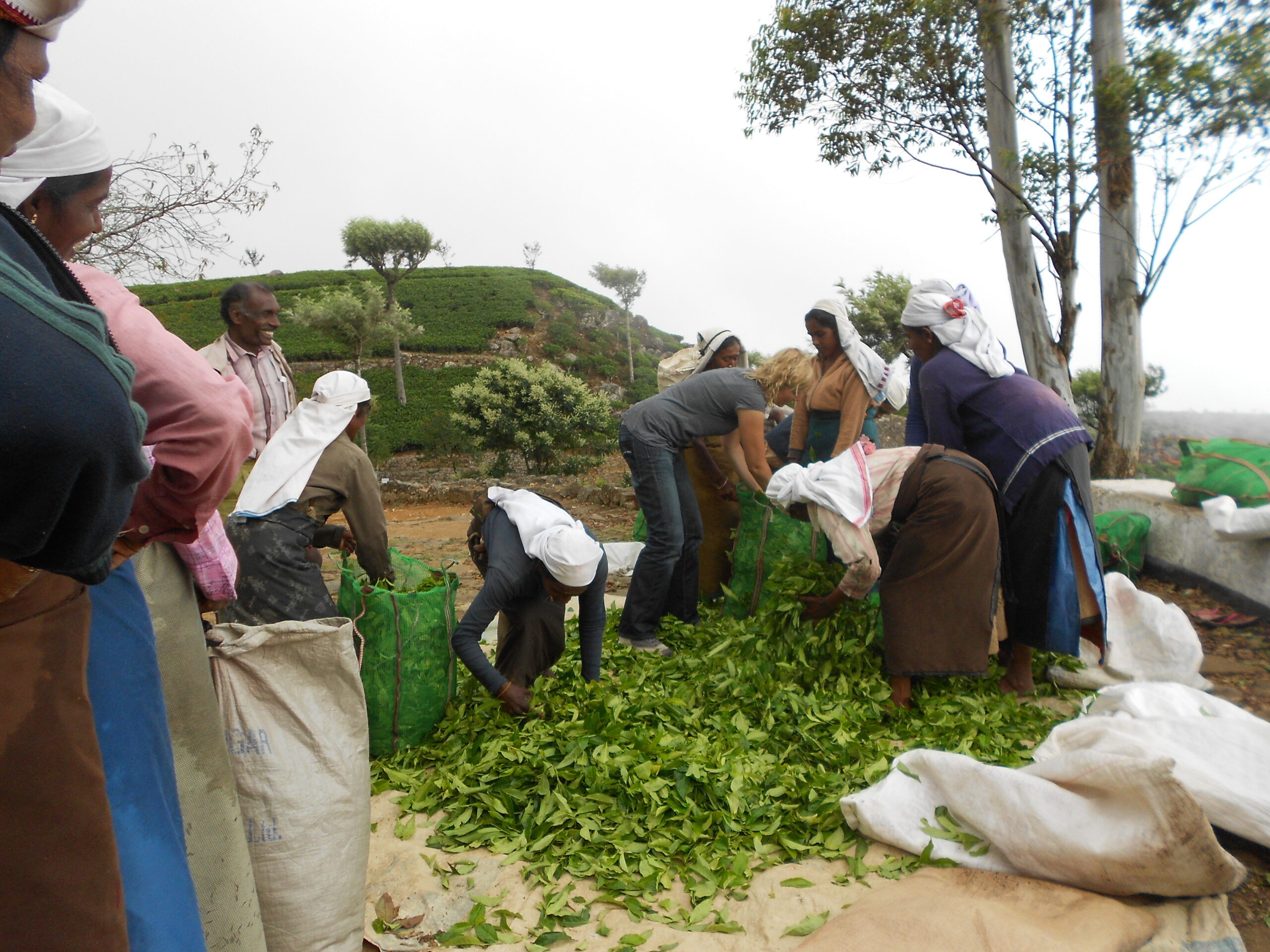
The Pekoe Trail, a part of the Serendipity Trails Collection, is a 300km and 22-stage long-distance hiking trail in the Central Highlands of Sri Lanka which traverses the vast network of tea trails that make up the Sri Lankan tea country and encapsulates the essence of the island’s diversity, seamlessly bringing …
The Pekoe Trail, Sri Lanka’s only long-distance hiking route and rapidly gaining a worldwide reputation,
The Pekoe Trail is an exciting new 300 km network of trails starting in Kandy, that has already been credited as one of the five most incredible walks in the world by the Financial Times in London. Funded by the European Union and USAID, this epic socially sustainable hike has been designed, expect stunning views, tea estates, lots of birds and small animals, rocky mountain summits if you’re up for it – and experience walking in what were once the sets of two internationally famous films: Indiana Jones and the Temple of Doom (Dir. Steven Spielberg, starring Harrison Ford) and Elephant Walk (starring Elizabeth Taylor).
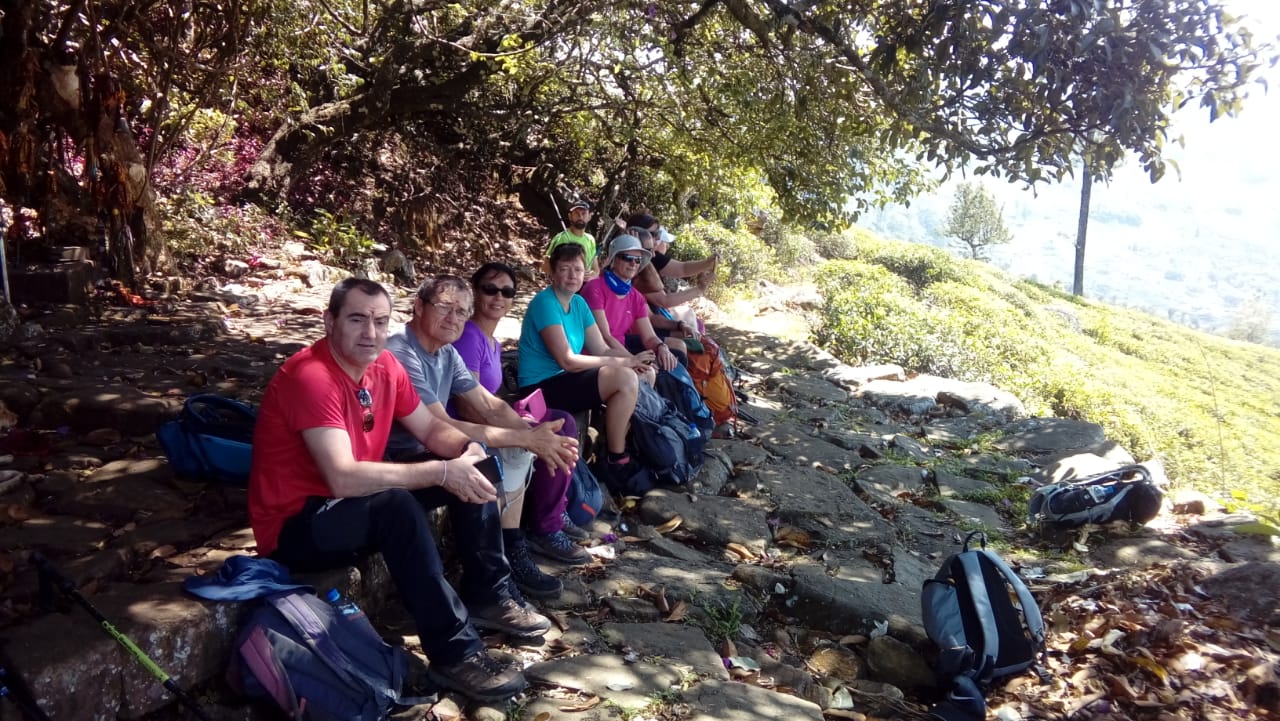
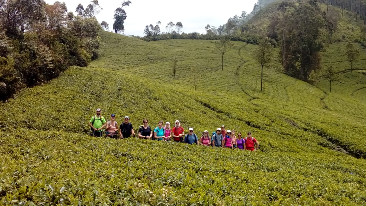
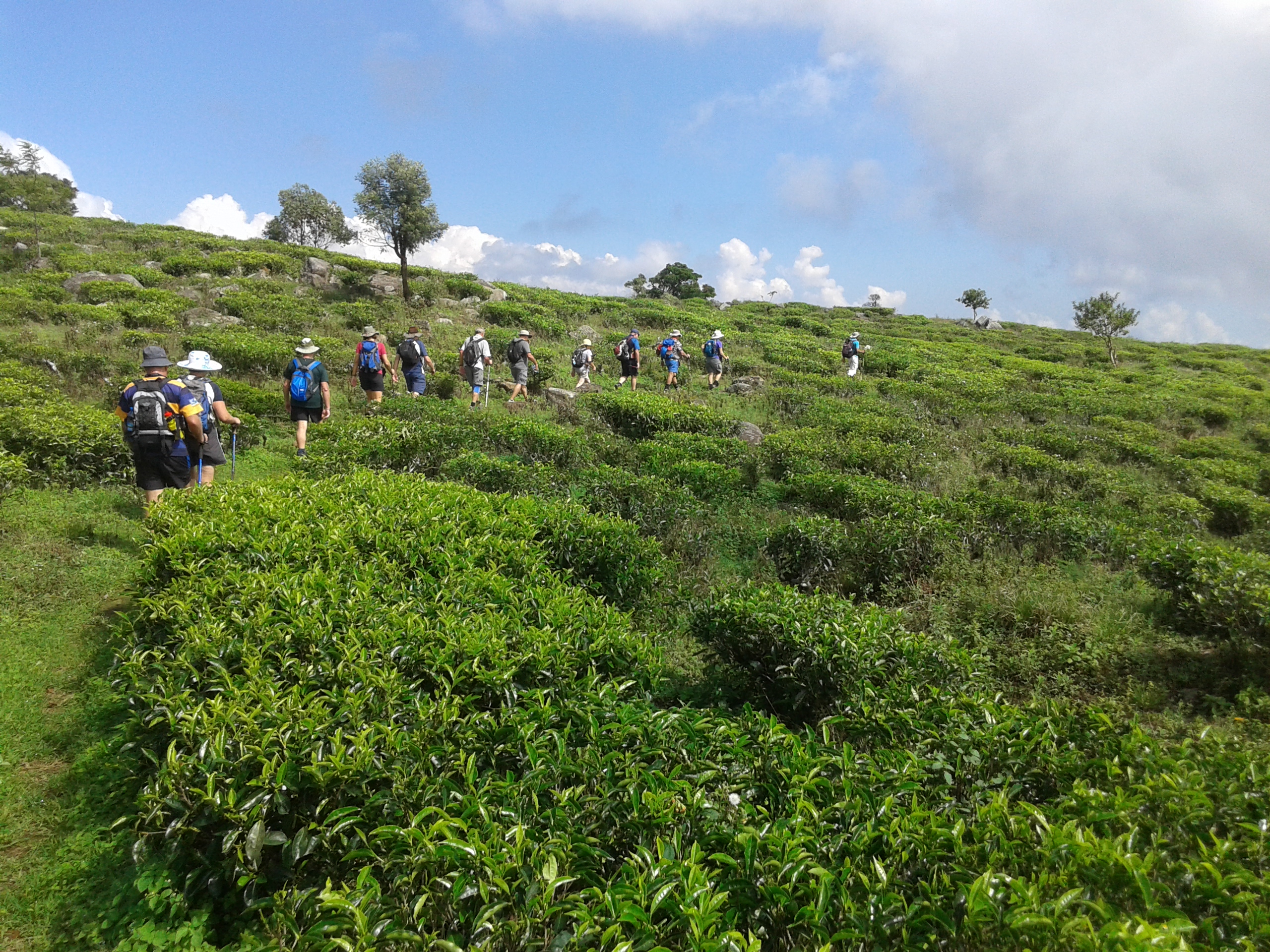
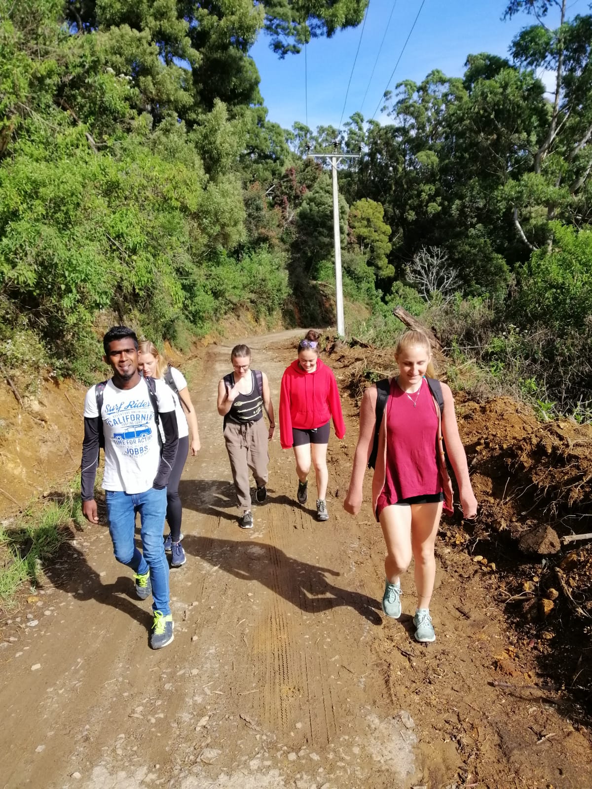
Sri lanka Trekking Club is an organization with 35 years of experience in arranging group tours and provide guided Trekking Tours for international tourists from all over the world. Our Tours cover the areas of Knuckles, Kandy, Matale, Ella, Haputale, Ohiya, Nuwara Eliya and Beliuloya.
A number of stages of the Pekoe Trail have been covered by us since many years. As for the future we will be expanding an provide our Guiding services to all of the 12 Stages of the Pekoe Trail.

The Pekoe Trail, Stage 10, Dayagama To Horton Plains with words end
Today is physically and mentally demanding, and also logistically
challenging. We start at Dayagama, one of the most remote villages in
the tea country. Dayagama lies at the far end of the Agarapatana Valley.
Very few tourists venture this far – this is a deep tea country
experience. Even though the valley lies in the very center of the
mountain ranges that form the Sri Lankan tea country, it doesn’t get
more remote than this.
You are going to need someone to pick you up at the endpoint, the old
Far Inn, which is inside the Horton Plains National Park. The drive from
the starting point to the endpoint is a long one. As the crow flies
it’s only 15 km however the main road loops back towards Nuwara Eliya
and then back on itself – a total of 65km to get from Dayagama to Horton
Plains. Your driver will probably only arrive shortly before you do.
The day is physically demanding because it is mostly uphill. That said
the trail is wide and easy to follow and the gradient is manageable.
Dayagama lies at 1421 meters above sea level and the Horton Plains
National Park at 2138 meters above sea level.
and if you are fit to do the words end trail in Horton’s plane about 10, KM, we can trek the park also,
Horton Plains National Park is a protected area in the central highlands of Sri Lanka and is covered by Montana grassland and cloud forest. This plateau at an altitude of 2,100– 2,300 metres (6,900–7,500 ft) is rich in biodiversity and many species found here are endemic to the region. This region was designated a national park in 1988. It is also a popular tourist destination.
The Horton Plains are the headwaters of three major Sri Lankan rivers, The plains’ vegetation is grasslands interspersed with montane forest, and includes many endemic woody plants. Large herds of Sri Lankan sambar deer feature as typical mammals, and the park is also an Important Bird Area with many species not only endemic to Sri Lanka but restricted to the Horton Plains. Forest dieback is one of the major threats to the park and some studies suggest that it is caused by a natural phenomenon. The sheer precipice of World’s End and Baker’s Falls are among the tourist attractions of the park.
| Distance 9.25 mi | Elevation gain 3,022 ft | Technical difficulty Difficult | Elevation loss 709 ft |
| Max elevation 7,014 ft | Trail rank 36 | Min elevation 4,662 ft | Trail type One Way |
| Lowest Rate Guarantee Cost For this program: – 90, US$ for person Every Extra person: – 70, US$ Transport from Horton’s plane to Haputale:-35.US$ | |
|
This is for: –
Picnic Lunch during treks Professional trekking guide Entrance fee for Horton plane | Trekking Level: – Difficult Trekking trail has ups and downs, and some steep |
The Pekoe Trail, Stage 11, Horton Plains to Udaweriya
Today’s stage starts at the Farr Inn, the old hunting lodge for high-ranking British colonial officials turned into a visitor center. Now run by the Department of Wildlife Conservation, the old inn is situated next to the car park from which almost all visitors start the walk to World’s End.
We are at the highest point of the entire Pekoe Trail at an elevation of 2170 meters. Depending on the time of the year or even the time of the day it can be cold, windy, misty, or open skies. During the months of May through to December, clouds roll over the plains from eastward so close to the ground you feel you can touch them. In January and February, the skies are blue, the air is dry and the sun beats down like the African savannah.
The name Devil’s Staircase was most likely given by Scottish Planters living in the area and taken from the long-distance footpath on the West Highland Way in the Scottish Highlands. There are other so-called “Devil Staircases” in various parts of the world, one in New Zealand and one in the state of Oregon. around the world, the good news is that there are no stairs! It’s a track.
The Pekoe Trail covers only the top section of the Devil’s Staircase – from the point at which the track meets the Ohiya-Horton Plains Road to a small village from where a trail cuts across the mountain around and over to the Udaweriya Valley. The views are truly breath-taking, all the way down and as you semi-circle around the mountain. On a clear day we can see Udawalawe National Park and beyond we might even see the coastline.
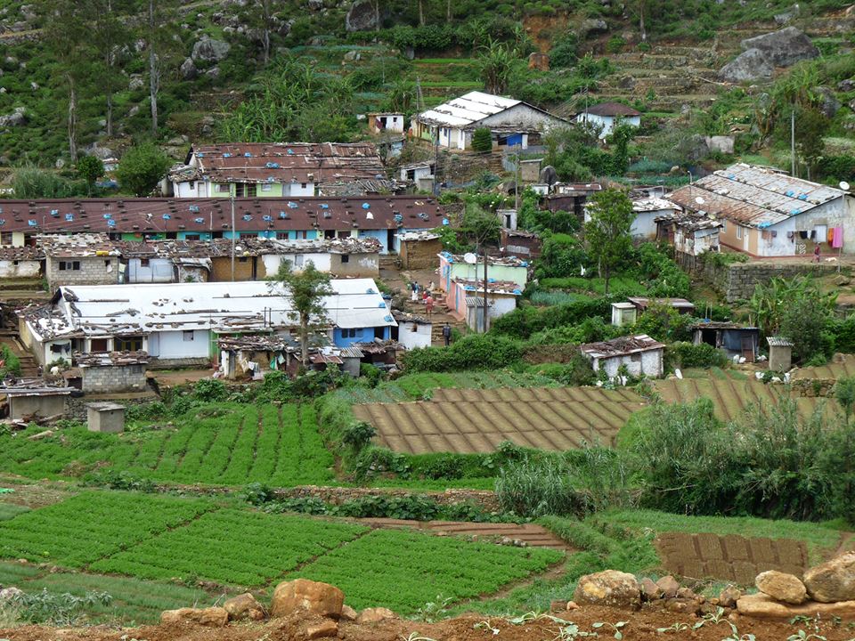
we leave one remote valley behind and enter the next. This is the lowest point of today’s walk at an elevation of 1618 meters. We call this valley the ‘hidden valley’ because it lies on the very edge of the tea country and its south-facing. The topography is so dramatic there are very few south-facing tea growing valleys in this area.
As we begin to ascend we look inwards and upwards at the old and abandoned Udaweriya Tea Factory, now largely a skeleton of steel beams. We keep on hiking up the trail towards a clear pass, through neat terraces of vegetables planted left and right. Small local homes are dotted around the valley.
| Distance 8.15 mi | Elevation gain 1,063 ft | Technical difficulty Moderate | Elevation loss 2,211 ft |
| Max elevation 7,119 ft | Trail rank 27 | Min elevation 5,295 ft | Trail type One Way |
| Lowest Rate Guarantee Cost For this program: – 90, US$ for person Every Extra person: – 70, US$ Without entering Hortons plane: – 45, US$ for person Every Extra person: – 30, US$ Transport From Haputale to Horton’s plane: -35.US$ From Ella, Haputale by Train to Ohiya and tuk tuk to Hortons plane: – 15.US$ | |
|
This is for: –
Picnic Lunch during treks Professional trekking guide Entrance fee for Horton plane | Trekking Level: – Moderate Trekking trail has ups and downs, but not so steep |
The Pekoe Trail, Stage 12, Udaweriya To Haputale
Today is one of The Pekoe Trail’s most exciting days. The Udaweriya Valley is one of the most remote valleys in the tea country. Some call it the hidden valley. The valley looks over the south of Sri Lanka and on a clear day you may just make out the ocean. The views are truly amazing, no doubt some of the best in the tea country.
We start at the old derelict tea factory. The first 1.7 km of the
trail is within the Udaweriya Valley. At the 1.7 km point, you peak at a
tea trail crossroads with an old house and that is your highest point
of the day at an elevation of 1948 meters.
From here all the way to Haputale is mostly a long, slow, gradual
descent. Very soon you will reach an abandoned village. If it were
populated this would qualify no doubt as one of the most remote villages
in the tea country. The track you are on saddles the lowlands to your
right and the Uva bowl to your left. How on earth did the British build
this seemingly impossible track? Once you pass the village the tea trail
becomes a walking path. This path is clearly used by local villagers to
go from Udaweriya down towards Haputale and Ella because it is
well-trodden and reasonably well maintained. At the 3 km point, the
trail penetrates a stretch of high elevation tropical forest for
approximately 1 km that resolves into a pine forest, bizarre as it
sounds. The contrast is mind-blowing. The trail through the pine forest
is an absolute delight
The next kilometer is on the train tracks, inevitably. If a train is
on the way you will hear it a long time before you see it. There is
plenty of room on both sides of the train track, so stay clear. There is
however a tunnel you must go through – there is no other way. Not ideal
but not a major problem. Just do it as quickly as you can – it’s
approximately 100 meters long, and only takes a minute or so to pass
through. Soon enough you’re on the trail again zig-zagging through the
Thangamale Sanctuary
The house was built in 1931 by an English aristocrat and planter Sir
Thomas Villiers, former Chairman of George Steuart & Co., a trading
and estate agency based in Colombo. Sir Thomas was a grandson of Lord
John Russell and descendant of the Dukes of Bedford. Named after
Adisham, it was designed by R. Booth and F. Webster in Tudor and
Jacobean style, on 10 acres (40,000 m2) of land. Adisham Hall played
host to many prominent personalities of the colony until the retirement
of Sir Thomas. In 1961 it was purchased by the Roman Catholic Church and
was subsequently converted to a monastery. The house is well preserved
along with its period fittings and furniture and is open to visitors.
| Distance 9.17 mi | Elevation gain 1,995 ft | Technical difficulty Difficult | Elevation loss 3,150 ft |
| Max elevation 6,457 ft |
Trail rank
25 | Min elevation 4,675 ft | Trail type One Way |
| Lowest Rate Guarantee Cost For this program: – 40, US$ for person Every Extra person: – 25, US$ Transport From Haputale to Starting point: -35.US$ From Ella, Haputale by Train to Ohiya and tuk tuk to Hortons plane: – 15.US$ | |
|
This is for: –
Picnic Lunch during treks Professional trekking guide Any Entrance fee | Trekking Level: – Moderate Trekking trail has ups and downs, but not so steep |
The Pekoe Trail, Stage 10, Dayagama To Horton Plains with words end, Stage 11, Horton Plains to Udaweriya, Stage 12, Udaweriya To Haputale
3, Days 2, Night
Day,1
Today is physically and mentally demanding, and also logistically challenging. We start at Dayagama, one of the most remote villages in the tea country. Dayagama lies at the far end of the Agarapatana Valley. Very few tourists venture this far – this is a deep tea country experience. Even though the valley lies in the very center of the mountain ranges that form the Sri Lankan tea country, it doesn’t get more remote than this.
You are going to need someone to pick you up at the endpoint, the old Far Inn, which is inside the Horton Plains National Park. The drive from the starting point to the endpoint is a long one. As the crow flies it’s only 15 km however the main road loops back towards Nuwara Eliya and then back on itself – a total of 65km to get from Dayagama to Horton Plains. Your driver will probably only arrive shortly before you do.
The day is physically demanding because it is mostly uphill. That
said the trail is wide and easy to follow and the gradient is
manageable. Dayagama lies at 1421 meters above sea level and the Horton
Plains National Park at 2138 meters above sea level.
and if you are fit to do the words end trail in Horton’s plane about 10, KM, we can trek the park also,
Horton Plains National Park is a protected area in the central highlands of Sri Lanka and is covered by Montana grassland and cloud forest. This plateau at an altitude of 2,100– 2,300 metres (6,900–7,500 ft) is rich in biodiversity and many species found here are endemic to the region. This region was designated a national park in 1988. It is also a popular tourist destination.
The Horton Plains are the headwaters of three major Sri Lankan rivers, The plains’ vegetation is grasslands interspersed with montane forest, and includes many endemic woody plants. Large herds of Sri Lankan sambar deer feature as typical mammals, and the park is also an Important Bird Area with many species not only endemic to Sri Lanka but restricted to the Horton Plains. Forest dieback is one of the major threats to the park and some studies suggest that it is caused by a natural phenomenon. The sheer precipice of World’s End and Baker’s Falls are among the tourist attractions of the park.
Over Night is a Simple Camping in a tea plantation by the Horton’s plane
Day,2
Today’s stage starts at the Farr Inn, the old hunting lodge for high-ranking British colonial officials turned into a visitor center. Now run by the Department of Wildlife Conservation, the old inn is situated next to the car park from which almost all visitors start the walk to World’s End.
We are at the highest point of the entire Pekoe Trail at an elevation of 2170 meters. Depending on the time of the year or even the time of the day it can be cold, windy, misty, or open skies. During the months of May through to December, clouds roll over the plains from eastward so close to the ground you feel you can touch them. In January and February, the skies are blue, the air is dry and the sun beats down like the African savannah.
The name Devil’s Staircase was most likely given by Scottish Planters living in the area and taken from the long-distance footpath on the West Highland Way in the Scottish Highlands. There are other so-called “Devil Staircases” in various parts of the world, one in New Zealand and one in the state of Oregon. around the world, the good news is that there are no stairs! It’s a track.
The Pekoe Trail covers only the top section of the Devil’s Staircase – from the point at which the track meets the Ohiya-Horton Plains Road to a small village from where a trail cuts across the mountain around and over to the Udaweriya Valley. The views are truly breath-taking, all the way down and as you semi-circle around the mountain. On a clear day we can see Udawalawe National Park and beyond we might even see the coastline.
we leave one remote valley behind and enter the next. This is the lowest point of today’s walk at an elevation of 1618 meters. We call this valley the ‘hidden valley’ because it lies on the very edge of the tea country and its south-facing. The topography is so dramatic there are very few south-facing tea growing valleys in this area.
As we begin to ascend we look inwards and upwards at the old and abandoned Udaweriya Tea Factory, now largely a skeleton of steel beams. We keep on hiking up the trail towards a clear pass, through neat terraces of vegetables planted left and right. Small local homes are dotted around the valley.
Over Night in a remote lodge in the tea plantation Dinner & Breakfast in the lodge
Day,3
Today is one of The Pekoe Trail’s most exciting days. The Udaweriya Valley is one of the most remote valleys in the tea country. Some call it the hidden valley. The valley looks over the south of Sri Lanka and on a clear day you may just make out the ocean. The views are truly amazing, no doubt some of the best in the tea country.
We start at the old derelict tea factory. The first 1.7 km of the
trail is within the Udaweriya Valley. At the 1.7 km point, you peak at a
tea trail crossroads with an old house and that is your highest point
of the day at an elevation of 1948 meters.
From here all the way to Haputale is mostly a long, slow, gradual
descent. Very soon you will reach an abandoned village. If it were
populated this would qualify no doubt as one of the most remote villages
in the tea country. The track you are on saddles the lowlands to your
right and the Uva bowl to your left. How on earth did the British build
this seemingly impossible track? Once you pass the village the tea trail
becomes a walking path. This path is clearly used by local villagers to
go from Udaweriya down towards Haputale and Ella because it is
well-trodden and reasonably well maintained. At the 3 km point, the
trail penetrates a stretch of high elevation tropical forest for
approximately 1 km that resolves into a pine forest, bizarre as it
sounds. The contrast is mind-blowing. The trail through the pine forest
is an absolute delight
The next kilometer is on the train tracks, inevitably. If a train is
on the way you will hear it a long time before you see it. There is
plenty of room on both sides of the train track, so stay clear. There is
however a tunnel you must go through – there is no other way. Not ideal
but not a major problem. Just do it as quickly as you can – it’s
approximately 100 meters long, and only takes a minute or so to pass
through. Soon enough you’re on the trail again zig-zagging through the
Thangamale Sanctuary
The house was built in 1931 by an English aristocrat and planter Sir
Thomas Villiers, former Chairman of George Steuart & Co., a trading
and estate agency based in Colombo. Sir Thomas was a grandson of Lord
John Russell and descendant of the Dukes of Bedford. Named after
Adisham, it was designed by R. Booth and F. Webster in Tudor and
Jacobean style, on 10 acres (40,000 m2) of land. Adisham Hall played
host to many prominent personalities of the colony until the retirement
of Sir Thomas. In 1961 it was purchased by the Roman Catholic Church and
was subsequently converted to a monastery. The house is well preserved
along with its period fittings and furniture and is open to visitors.
| Cost For this program: -280, US$ for person Every Extra person: – 220, US$ | |
|
This is for: –
Picnic Lunch during treks Professional trekking guide 1, Night Accommodation in a Simple Camping with Dinner & Breakfast 1, Night Accommodation in a lodge Any Entrance fee | Trekking Level: – Moderate Trekking trail has ups and downs, but not so steep Accommodation is Simple |
The Pekoe Trail Stage 11, Horton Plains to Udaweriya, Stage 12, Udaweriya To Haputale with over night
2, Days 1, Night
Today’s stage starts at the Farr Inn, the old hunting lodge for high-ranking British colonial officials turned into a visitor center. Now run by the Department of Wildlife Conservation, the old inn is situated next to the car park from which almost all visitors start the walk to World’s End.
We are at the highest point of the entire Pekoe Trail at an elevation of 2170 meters. Depending on the time of the year or even the time of the day it can be cold, windy, misty, or open skies. During the months of May through to December, clouds roll over the plains from eastward so close to the ground you feel you can touch them. In January and February, the skies are blue, the air is dry and the sun beats down like the African savannah.
The name Devil’s Staircase was most likely given by Scottish Planters living in the area and taken from the long-distance footpath on the West Highland Way in the Scottish Highlands. There are other so-called “Devil Staircases” in various parts of the world, one in New Zealand and one in the state of Oregon. around the world, the good news is that there are no stairs! It’s a track.
The Pekoe Trail covers only the top section of the Devil’s Staircase – from the point at which the track meets the Ohiya-Horton Plains Road to a small village from where a trail cuts across the mountain around and over to the Udaweriya Valley. The views are truly breath-taking, all the way down and as you semi-circle around the mountain. On a clear day we can see Udawalawe National Park and beyond we might even see the coastline.
we leave one remote valley behind and enter the next. This is the lowest point of today’s walk at an elevation of 1618 meters. We call this valley the ‘hidden valley’ because it lies on the very edge of the tea country and its south-facing. The topography is so dramatic there are very few south-facing tea growing valleys in this area.
As we begin to ascend we look inwards and upwards at the old and abandoned Udaweriya Tea Factory, now largely a skeleton of steel beams. We keep on hiking up the trail towards a clear pass, through neat terraces of vegetables planted left and right. Small local homes are dotted around the valley.
Over Night in a remote lodge in the tea plantation Dinner & Breakfast in the lodge
After breakfast in the lodge, we start our trekking, Today is one of The Pekoe Trail’s most exciting days. The Udaweriya Valley is one of the most remote valleys in the tea country. Some call it the hidden valley. The valley looks over the south of Sri Lanka and on a clear day you may just make out the ocean. The views are truly amazing, no doubt some of the best in the tea country.
We start at the old derelict tea factory. The first 1.7 km of the
trail is within the Udaweriya Valley. At the 1.7 km point, you peak at a
tea trail crossroads with an old house and that is your highest point
of the day at an elevation of 1948 meters.
From here all the way to Haputale is mostly a long, slow, gradual
descent. Very soon you will reach an abandoned village. If it were
populated this would qualify no doubt as one of the most remote villages
in the tea country. The track you are on saddles the lowlands to your
right and the Uva bowl to your left. How on earth did the British build
this seemingly impossible track? Once you pass the village the tea trail
becomes a walking path. This path is clearly used by local villagers to
go from Udaweriya down towards Haputale and Ella because it is
well-trodden and reasonably well maintained. At the 3 km point, the
trail penetrates a stretch of high elevation tropical forest for
approximately 1 km that resolves into a pine forest, bizarre as it
sounds. The contrast is mind-blowing. The trail through the pine forest
is an absolute delight
The next kilometer is on the train tracks, inevitably. If a train is
on the way you will hear it a long time before you see it. There is
plenty of room on both sides of the train track, so stay clear. There is
however a tunnel you must go through – there is no other way. Not ideal
but not a major problem. Just do it as quickly as you can – it’s
approximately 100 meters long, and only takes a minute or so to pass
through. Soon enough you’re on the trail again zig-zagging through the
Thangamale Sanctuary
The house was built in 1931 by an English aristocrat and planter Sir
Thomas Villiers, former Chairman of George Steuart & Co., a trading
and estate agency based in Colombo. Sir Thomas was a grandson of Lord
John Russell and descendant of the Dukes of Bedford. Named after
Adisham, it was designed by R. Booth and F. Webster in Tudor and
Jacobean style, on 10 acres (40,000 m2) of land. Adisham Hall played
host to many prominent personalities of the colony until the retirement
of Sir Thomas. In 1961 it was purchased by the Roman Catholic Church and
was subsequently converted to a monastery. The house is well preserved
along with its period fittings and furniture and is open to visitors.
| Lowest Rate Guarantee Cost For this program: – 120, US$ for person Every Extra person: – 90, US$ Without entering Horton plane: – 100, US$ for person Every Extra person: – 70, US$ Transport From Haputale to Starting point: -35.US$ From Ella, Haputale by Train to Ohiya and tuk tuk to Hortons plane: – 15.US$ | |
|
This is for: –
Picnic Lunch during treks
1,Night Accommodation with dinner & breakfast Professional trekking guide Any Entrance fee | Trekking Level: – Moderate Trekking trail has ups and downs, but not so steep |
The Pekoe Trail, Stage 13, Haputale To St. Catherine
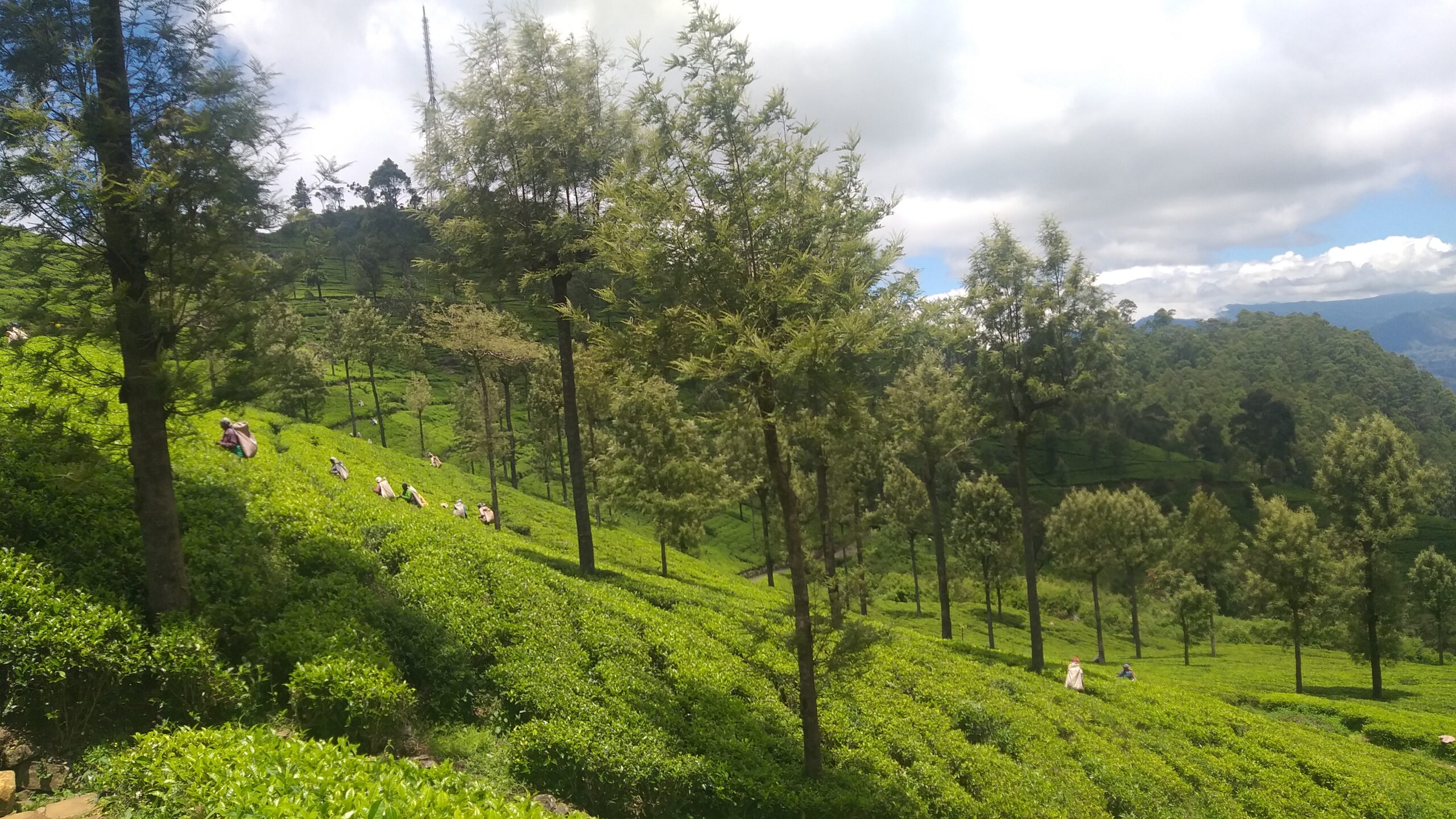
This is a very scenic route that takes you from one of the major towns in the tea country, Haputale, to one of the tea country’s better-known landmarks, the upper divisions of the Nayabedda Tea Estate from where Sir Thomas Lipton would survey his favorite tea estates, where the panoramic views of the mountains, and rivers are truly breath-taking. The next kilometer is a forest reserve, cool and humid – ideal for walking uphill in the shade. The trail resolves onto a tea estate road.
The trail gradually descends for 300 meters and then you’ll start climbing uphill following a very well-marked and beautiful tea trail. You are walking on the paths of an organic bio-tea producing estate called Green Field.
Now we start a much steeper climb towards the top of the mountain. Your guide is the telecom tower on the top. You will eventually reach the top of the mountain which is more or less at the same height as Lipton Seat. You’ve reached a kind of plateau with lots of green tea fields and a few small villages.
Today’s stage ends at St. Catherine, the first picturesque tea plantation worker’s village you will encounter on the upper divisions of the Nayabedda Tea Estate, at an altitude of 1875 meters. 100 meters before you enter the village there’s an impressive Hindu Kovil on your right. Remember to take your shoes off if you decide to enter the complex and pay homage to the deities.
Some may want to keep walking and visit Lipton Seat, it’s another 3 km across the plateau. Lipton Seat is a popular destination for local tourists so you might see a little bit of traffic at the end. Lipton’s seat requires taking a picture of yourself with a statue of Sir Thomas Lipton surrounded by panoramic views. On a clear day, one can see as far as Udawalawe National Park and almost the entire Uva Province.
| Lowest Rate Guarantee Cost For this program: – 40, US$ for person Every Extra person: – 25, US$ Transport From Haputale Or Bandarawela to Starting point: -20.US$ Distance 8.38 mi Elevation gain 3,022 ft Technical difficulty Difficult Elevation loss 709 ft Max elevation 7,014 ft Trail rank 36 Min elevation 4,662 ft Trail type One Way | |
|
This is for: –
Picnic Lunch during treks Professional trekking guide Any Entrance fee | Trekking Level: – Moderate Trekking trail has ups and downs, but not so steep |
The Pekoe Trail, Stage 14, St. Catherine (Lipton Seat) To Makulella
Today’s stage starts at St. Catherine, situated in the upper division of Nayabedda Tea Estate at an altitude of 1875 meters, the second-highest starting point of all The Pekoe Trail stages. Although the total length of the stage is only just over 9.5 km, this stage is packed with all the magic of the trail; villages, places of worship, tea plantations, farms, historic bungalows, forested areas, and endless, never-ending breathtaking views of the mountains and valleys below as we descend towards Liyangahawela and then onto Makulella. The stage ends at an altitude of 1262 meters, so if you are considering doing it in reverse it’s a climb, albeit a very special day. This is partly the reason the stage works very well as a 9.5 km stage but either way, you do it, this one is truly spectacular.
The weather on the upper divisions of the Nayabedda Estate is unstable so make sure you are well equipped. Temperatures can drop suddenly and considerably when the clouds set in. When the sun is shining, it’s a strong tropical sun, so be sure to wear a hat and apply sun cream.
St. Catherine is a tea plantation workers’ village sitting high up on a plateau well known because of Lipton Seat, the place from where Sir Thomas Lipton liked to survey his tea empire.
The first 500 meters cross the plantation village of St. Catherine and the village homes that surround the town. Every square inch of the land around every village home is used for cultivation, be it vegetables like carrots or beans, leaks, or cabbage. Much of the produce is then sold by the local villagers at the markets of Haputale and Bandarawela. At the 500-meter mark, we enter a short patch of Eucalyptus Forest and then begin a gradual zig-zag descent towards the edge of the plateau, passing by more village homes, cultivations, and tea.
At the 1.5 km point, we leave the last little hamlet behind on our right-hand side. Soon after a short patch of forest, the trails give way to one of the most spectacular locations on the entire Pekoe Trail. Presiding over this incredible place is an old and hollow pine tree the local villagers come to honor and respect.
“As you sit on the hillside, or lie prone under this great tree, the great door, that does not look like a door, opens” – Stephen Graham, The Gentle Art of Tramping, 1926
The highest mountain you see in front of you is called Namunukula, which in Sinhala means “Nine Peaks”. Its main peak is 2,036 meters high. According to Wikipedia during the Ming treasure voyages of the 15th century, the Chinese fleet led by Admiral Zheng made use of this geographical feature in their navigation to Sri Lanka, as the mountain is the first visible landmark of Sri Lanka after departing from Sumatra. the village immediately below. Balagala has a very impressive and enormous Hindu Kovil you will see looking up on your left-hand side as you cross the village.
| Distance 5.83 mi | Elevation gain 600 ft |
Technical difficulty
Moderate | Elevation loss 2,690 ft |
| Max elevation 6,142 ft | Trail rank 29 4.7 | Min elevation 4,0492 ft | Trail type One Way |
| Lowest Rate Guarantee Cost For this program: – 40, US$ for person Every Extra person: – 25, US$ Transport From Haputale Or Bandarawela to Starting point: -20.US$ | |
|
This is for: –
Picnic Lunch during treks Professional trekking guide Any Entrance fee | Trekking Level: – Moderate Trekking trail has ups and downs, but not so steep |
The Pekoe Trail, Stage 15, Makulela to Ella Via Ella rock
Today’s stage begins at Makulella, at the temple of Allimale Bodhiya, a lovely Buddhist Temple overlooking the valley below which goes by the name of Ambagaswatte.
The river flowing through the valley gives way to the Ravana Falls, a popular stop on the Ella to Wellawaya road below. This spectacular waterfall was named after legendary King Ravana, described in the Ramayana. According to legend, King Ravana hid princess Sita inside a cave behind this waterfall.
The stage starts at an elevation of 1240 meters and ends at an elevation of just over 1000 meters. The first part of the stage is a delightful walk through a forested area. At the 800-meter point, you will see the trail splits into two, one way peeling off to the right which is effectively a gateway to the Ambagaswatte valley, and then a forest track straight ahead. Keep going straight through the eucalyptus forest.
The views on the right-hand side are stunning. The trail penetrates a patch of jungle and shortly after emerges onto a much wider trail. Ella Rock sits at the 4.5 km point of today’s walk, the quieter more peaceful, and serene half. Needless to say, the view from Ella Rock is spectacular. Expansive vistas of the valley below, little Adam’s Peak on the other side of the valley, and the many mountains and valleys beyond.
From here on The Pekoe Trail mirrors the popular trail many of the travelers staying in Ella use to climb up to the rock as a day trip. The first 200 meters are a steep descent, first through the eucalyptus forest and then passing a few local homes and their cultivated gardens all the way to Kithal Ella Station.
From Kithal Ella Station there is no option but to walk along the railway track for approximately 1.5 km. Today’s stage finishes at the Ella Train Station. Ella railway station is the 75th station on the Main Line and is located 271.03 km from Colombo. Ella is a very popular hill-country town where travelers come to enjoy walks through tea plantations and nature, and generally to chill out.
| Distance 6.29 mi | Elevation gain 741 ft | Technical difficulty Moderate | Elevation loss 1,424 ft |
| Max elevation 4,429 ft | Trail rank 26 2.7 | Min elevation 3,369 ft | Trail type One Way |
| Lowest Rate Guarantee Cost For this program: – 40, US$ for person Every Extra person: – 25, US$ Transport From Bandarawela to Starting point: -20.US$ | |
|
This is for: –
Picnic Lunch during treks Professional trekking guide Any Entrance fee | Trekking Level: – Moderate Trekking trail has ups and downs, but not so steep |

The Pekoe Trail, Stage 16, Ella to Demodera
Ella draws travelers to Sri Lanka’s highlands with its mountain forests, tea plantations, and relatively cool climate and is a very popular stop, start, or ending point along the trail. Starting at the train station, today’s walk to Demodera is very doable and very easy. It is one of the shortest stages of The Pekoe Trail and one of the most popular ones.
As you leave Ella town walking along you will see the famous Nine Arches Bridge. This is a popular trail. You will be sure to meet a few other hikers on their way to or from the Nine Arches Bridge. The bridge is hauntingly beautiful and a major tourist attraction.
This exceptional Nine Arches Bridge is known as the bridge in the sky and is 80 feet high, and 300 feet long. The bridge was built during the colonial period in extremely challenging times as the original materials meant for creating it such as steal were allegedly relocated by Britain to resource the Great War. So instead in the end only made out of stone, brick and cement.
We enter the Demodara Tea Estate and walk upon a lovely tea trail and at the 4.5 km point, we leave the main trail and take a second one to our left. Look back and you’ll see the Nine Arches Bridge again but this time much further away. We follow this track for half a kilometer until we reach a small Buddhist shrine. Along the way, you’ll pass by the modest home of a cheerful family and no doubt hear the ‘maa’ greeting of the family of goats they care for.
Once you’re back on the main tea trail running through the Demodara estate we loop around this lovely estate for approximately 3 km. You’ll see a lovely lake on your left as you descend towards Demodara.
This is the story of this intriguing feat of engineering:
Demodara railway station is known for its spiral rail line at this location, popularly known as the ‘Demodara Loop’. The rail line passes under itself, going around the loop and emerging from a tunnel. The rail loop is approximately 900 meters.
“During construction, the engineers found that elevation between the hills at Demodara was too much for the track to negotiate, with the maximum inclination allowed by the Ceylon Government Railway being one foot per 44 feet (1/44), an innovative track design had to be devised. Local folklore has it that one of the engineers, Devapura Jayasena Wimalasurendra, was inspired after observing a Kankany (supervisor) in a local tea estate undo his turban and re-tie it around his head” (Wikipedia)
| Distance 5.43 mi | Elevation gain 1,289 ft | Technical difficulty Easy | Elevation loss 1,719 ft |
| Max elevation 3,497 ft | Trail rank 29 4.7 | Min elevation 2,933 ft | Trail type One Way |
| Lowest Rate Guarantee Cost For this program: – 40, US$ for person Every Extra person: – 25, US$ | |
|
This is for: –
Picnic Lunch during treks Professional trekking guide Any Entrance fee | Trekking Level: – Moderate Trekking trail has ups and downs, but not so steep |
The Pekoe Trail, Stage 17, Demodera To Hali-Ela
This stage begins at a point easily visible from the Demodara train
station, at which point the train line does a spiral through a tunnel
that actually runs beneath the railway station and winds around the
mountain.
The first kilometer runs along the fairly wide Demodera-Spring Valley
Road. Heading northeast, we wrap around the small hill where Nine Skies
Bungalow is located; a delightful old planter’s house restored and
operated as a small boutique hotel by the Teardrop Collection.
The trail we are on for nearly the rest of today is clear and the views,
as you gradually descend towards Hali-Ela, are idyllic. This is a very
rarely visited part of the tea country, yet adorable. The next 3 km are
fairly straight and all downhill. At the 8 km point, we arrive at a
junction beside a stunning gigantic purple Bougainvillea. We take the
‘second exit’, leading straight down a leafy path. The next few hundred
meters offer plenty of well-deserved shade, as the trail runs through a
patch of forest with enormous trees everywhere.
‘The Uva Club was the focal point of the social life of the expatriate
planter. It was founded before the railway was opened as far as Haputale
in September 1894 and eventually reached Badulla in April 1924. Much of
the development would have been initiated, shared, discussed, and
planned at these social gatherings at the club.’
As we exit the Uva Planters’ Club, we will see a small road on our right
leading to the Unugala Hospital. We follow the tarmac road until the
12.5 km point and take the steps down to the train station. If you feel
more comfortable on the tarmac road keep going as it takes you to the
train station as well. Hali-Ela Train station marks the end of the
stage.
| Distance 7.79 mi | Elevation gain 1,716 ft | Technical difficulty Moderate | Elevation loss 2,231 ft |
| Max elevation 3,921 ft | Trail rank 35 | Min elevation 2,451 ft | Trail type One Way |
| Cost For this program: – 40, US$ for person Every Extra person: – 25, US$ | |
|
This is for: –
Picnic Lunch during treks Professional trekking guide Any Entrance fee | Trekking Level: – Moderate Trekking trail has ups and downs, but not so steep |
The Pekoe Trail, Stage 18, Hali Ela to Ettampitiya
Today’s stage is a challenging uphill day. We are going to ascend from the town of Hali-Ela sitting at an elevation of 730 meters, to the town of Ettampitiya sitting at an elevation of 1246 meters above sea level. The general direction of the trail turns first northwest and then southwest. This is a very remote part of the tea country.
We start at the Hali-Ela Train station or at Hali-Ela Town itself. We exit the town on a village road that runs in between paddy cultivations in the directions of the houses ahead. we reach the Sri Bimbarama Temple. If you decide to visit the temple, be sure to cover your shoulders and legs – time to take out the sarong you have in your rucksack.
During the next 150 meters, we are walking uphill past local homes and then once we get to the top of the hill it’s a gradual descent through a mix of cultivated land and village homes until we reach the Ketawala The Pekoe Trail descends towards the paddy below and hops over onto the other side of the stream. The trail twists and turns past village homes and eventually resolves onto a tea estate. At this stage, we are still at the bottom of the valley and this is where we begin to climb up. Our objective is to reach the iconic Dickwella Tea Factory sitting at the top of the hill.
At the 3.1 km point, we reach the impressive Stupa of the Sri Sambodhi Temple. So far today, we’ve walked past two very prominent Buddhist Temples. The next 4 km are all a gradual ascent. We are going to be gaining approximately 300 meters of elevation in 4 km on estate roads – there are no steps, it’s just a gradual ascent. As we gain elevation the views of the valley below are all the more spectacular. We peak at the 7 km point when we reach a few old tea sheds sitting on the side of the Katawala – Ettampitiya Road. We then turn left and walk on the tarmac road for 300 meters and then take the tea trail that dog-legs up again to your left.
The next 1.5 km take us back towards the valley behind us, around the
hill, and past the Dickwella Tea Factory sitting immediately above us.
The views of the valley below are truly spectacular. At the 8.9 km post,
we reach a small shop – a good place to stock up on water and take a
rest. We then walk for 700 meters on the road and then you will see a
fork on the road with a clear tea trail peeling off to the left and the
road you are on peeling off to the right. Take the tea trail.
The next 1.5 km are on tea trails. You will pass a small lake to your
right. The Pekoe Trail then touches the main road again at the 10.6 km
post and then peels off again onto a lovely tea trail. At the 11.3 km
point be sure to take the smaller tea trail heading up to your right
towards the tea plantation worker houses immediately ahead of you. We
zig-zag up and saddle onto the top of the hill and then make our way
down to the road through the houses. which is when entering the more
urbanized surroundings of Ettampitiya
| Distance 8.67 mi | Elevation gain 2,316 ft | Technical difficulty Difficult | Elevation loss 705 ft |
| Max elevation 4,124 ft | Trail rank 32 | Min elevation 2,395 ft | Trail type One Way |
| Cost For this program: – 40, US$ for person Every Extra person: – 25, US$ | |
|
This is for: –
Picnic Lunch during treks Professional trekking guide Any Entrance fee | Trekking Level: – Moderate Trekking trail has ups and downs, but not so steep |
The Pekoe Trail, Stage 19, Ettampitiya To Lunuwatte
Today’s stage starts at Ettampitiya, a small yet busy town with
plenty of shops to stock for the walk. It’s an 18 km stage divided into
two very distinct parts. The first 8 km is a gradual descent towards the
crossing of the region’s most distinctive river the Uma Oya. The Uma
Oya is born at Pidurutalagala, the tallest mountain in Sri Lanka
towering over Nuwara Eliya, at an elevation of 2,524 meters. The river
eventually connects with the great Mahaweli, the longest river in Sri
Lanka. The crossing of the Uma Oya is a very significant landmark of the
trail, as this is the point from where we gradually begin to ascend to
Nuwara Eliya, 4 stages ahead of us.
The second 10 km run through some of the most remote parts of the tea
country; there is very little tourism here. To us this part of the
country looks a lot like Bali. We are definitely off the beaten path
here…
We begin by walk main road for just 150 meters and then turn right onto a gravel road. We are immediately surrounded by tea fields with a few village homes peppered around. At the 1.1 km point, the tea trail we are on connects with a tarmacked village road, and then The Pekoe Trail peels off to the right and we’re back on a tea estate road that leads us all the way down to the Ettampitiya Estate Bungalow. We keep descending on the estate road and then, at the 2.2 km point we dog-leg back up, this time on a tarmacked village road. We walk uphill on the road for 700 meters and, at the fork, we take the right trail.
It’s a very straight path down the hill passing a few village homes on either side. There is also a local school on the right-hand side called Dehiwwina. At the 4.4 km point, we arrive the Pallawela Temple, a lovely and serene Buddhist temple. We keep on descending and the trail becomes gradually steeper. Over the next 2.5 km, we are going to descend approximately 250 meters in elevation. Unfortunately, there is a section of the trail that are steps, but not for long, and at the very bottom awaits a truly delightful sight and experience – an old suspension bridge we will be crossing. At the time of writing the suspension bridge was open and passable but if you have any doubts, then simply walk down to the river bed as there is a concrete path that crosses the river. The river is a lively place – you might find kids swimming or villagers washing their clothes.
We’re back on lovely tea trails till the 16.5km post where we cross a picturesque section of paddy. This part of the tea country reminds us of Bali / Ubud. Up and then down again to cross another section of paddy at the 17.8 km post. From here its 1km up the road to Lunuwatte.
| Distance 11.56 mi | Elevation gain 2,149 ft | Technical difficulty Difficult | Elevation loss 2,595 ft |
| Max elevation 4,104 ft | Trail rank 25 | Min elevation 2,858 ft | Trail type One Way |
| Cost For this program: – 40, US$ for person Every Extra person: – 25, US$ | |
|
This is for: –
Picnic Lunch during treks Professional trekking guide Any Entrance fee | Trekking Level: – Moderate Trekking trail has ups and downs, but not so steep |

The Pekoe Trail, Stage 20, Lunuwatte to Uda Pussellawa
Today’s stage starts in Lunuwatte town heading west on a village road towards the Sri Wisuddharamaya Temple. Within a short distance, you’ll see a pretty lake on the left-hand side and the temple to your right.
We continue straight down towards the paddy fields below. At the 1.5 km post, we begin to ascent in between village homes. The next km is probably the hardest part of today’s walk as we ascend zig-zagging up village roads until we enter the eucalyptus forest. We leave the village behind and from here on, all the way to the end, we’re in forests and tea plantations, with a total of 10 km of quiet countryside ahead of us – half uphill and half downhill.
At the 3 km point, we enter the eucalyptus and pine forest as we gradually ascend. Don’t be intimidated by the mountain ahead of you, The Pekoe Trail circumvents the forested hill on the eastern side. The dominant plants on the hill are large eucalyptus trees apparently planted to stabilize the slope after the original forest was cleared some thirty years ago. Enjoy the wilderness and the views to the east as you follow the contour of the hill. The trail is thin but clear –a “category 1 trail“ at this stage.
At the 4.5 km point, we arrive at the Sthripura Caves, an important cave network stepped in myth. Sthripura, also spelled Isthripura, is derived from Sanskrit and Sinhalese word Sthri which means woman, and Pura meaning town, and refers to a mythical incident where King Walagamba (who died in 77 BC) hid 500 queens in a cave to protect them (Basnayake, 1983).
From here we head northwest on the clearly visible tea trail ahead of us. Leaving a small estate worker village to our left we walk on tea trails gradually ascending all the way to the top. At the 6 km point, we pass by the Estate’s Managers Bungalow.
At the 6.8 km point, we arrive at the tea-trail junction that saddles both valleys and sits on the border between the Central and Uva provinces. We take the trail to the right and follow the trail on the ridge for approximately 1.5 km including a few hundred meters of pine forest. The views from here are stunning.
At the 8.7 km point, we begin to descend first through another eucalyptus forest and then down the maze of tea trails before us. If you look up ahead you are looking in the general direction of The Pekoe Trail – and the day ahead which is Uda Pussellawa to Ragala.
At the 10.7 km point, having descended for a while, you will find yourself walking uphill for a hundred meters again and then crossing a small bridge. From here the end of the stage, Uda Pussellawa town, is only 1.5 km away. The tea trail we are on links with an old country road that heads down to the village. We then descend gradually towards Uda Pussellawa, town is a reasonably large village, a transport and commercial hub with basic facilities, shops, and ATMs. We love this day!
| Distance 7.69 mi | Elevation gain 2,241 ft | Technical difficulty Moderate | Elevation loss 1,558 ft |
| Max elevation 5,292 ft | Trail rank 25 | Min elevation 3,474 ft | Trail type One Way |
| Cost For this program: – 40, US$ for person Every Extra person: – 25, US$ | |
|
This is for: –
Picnic Lunch during treks Professional trekking guide Any Entrance fee | Trekking Level: – Moderate Trekking trail has ups and downs, but not so steep |
The Pekoe Trail, Stage 21, Uda Pussellawa to Kandapola
Today’s stage starts in Uda Pussellawa at an elevation of 1,275 meters and ends in Kandapola at an elevation of 1,936 meters. The elevation gain is considerable but well worth the physical effort and remember, we are walking on tea trails, so the ascent is gradual and manageable. Uda Pussellawa is a small but lively town with all the services you need: fruit sellers, small supermarkets, a bank, and a pharmacy. Take plenty of water with you.
We follow the main road out of town in the direction of Ragala for the first 700 meters of the trail and then peel off to the left as we begin to ascend on a well-trodden dirt track the villagers use. At the 1.7 km point, the trail turns back on itself, as we saddle onto the other side of this small valley. We zig-zag through verdant tea fields for 3 km and at the 4.7 km point we reach the highest point of this first section. We are walking on the Gordon Estate, along the border of the Central and Uva provinces. From here, we descend for another 2 km enjoying the spectacular views of the valleys below until we reach the “Ambalama Junction”, at the 6.7 km point.
From here, it’s a 6 km hike up towards Kandapola. The trail traces an old south-facing secondary road that takes us all the way up the hill. As we ascend, we are treated to sprawling views of the Uva bowl. On a clear day, one can easily make out the contour of Haputale, Lipton Seat, and Ella Rock, wrapping around the Uva bowl. This part of the tea country is also prolific at producing vegetables. People here are farming every centimeter of soil available for cultivation, to grow carrots or leeks.
At the 10.1 km point, we leave all the vegetable cultivations behind, as the trail takes us through the forest for approximately 3 km. This is a patch of autochthonous high-elevation rainforest. You’re on an old, virtually abandoned secondary road connecting Kandapola and the Uva Province. The forest is teeming with wildlife, birds, monkeys and, of course, leopards as well. The change in temperature as you ascend is very noticeable, especially as you traverse and exit the forest.
At the 13 km point, we leave the forest behind and reach the highest point of today’s walk. We are now walking on tea trails and contemplating Hethersett Estate fields, and the iconic Tea Factory Hotel just in front of us.
The Heritance Tea Factory Hotel is a great example of how tourism can contribute to heritage conservation, by turning an abandoned tea factory into a hotel. In 2007, the Sunday Times UK listed The Tea Factory Hotel among the ‘100 Best Places to Stay in the World.
The trail loops around the hotel and heads down towards Kandapola. This exciting stage ends in front of the petrol station in the center of town.
| Distance 10.38 mi | Elevation gain 3,638 ft | Technical difficulty Difficult | Elevation loss 1,506 ft |
| Max elevation 6,588 ft | Trail rank 25 | Min elevation 4,183 ft | Trail type One Way |
| Cost For this program: – 40, US$ for person Every Extra person: – 25, US$ | |
|
This is for: –
Picnic Lunch during treks Professional trekking guide Any Entrance fee | Trekking Level: – Moderate Trekking trail has ups and downs, but not so steep |
The Pekoe Trail, Stage 22, Kandapola To Pedro Estate
This is the final stage of The Pekoe Trail. Congratulations! Or perhaps it’s the first – if you are walking the trail in reverse – any way will do!
The trail starts at Kandapola town, a small yet busy transit town located 14 km east of the regional capital Nuwara Eliya. Take the road directly opposite the Petrol Station, and stay on this road for close to 2 KM where the trail peels off to the left, just in front of an old warehouse.
Here’s where you leave the village behind and for the next 8 km the trail is on tea estate tracks. Do note that there is very little shade here and hence on a sunny day you’ll need protection from the sun. Likewise on a windy and rainy day the temperatures here can drop and you’ll need a warm layer and possibly a raincoat.
We circle around the Courtlodge Tea Factory, one of the oldest tea estates in the region, established In 1890. The trail meanders peacefully up and down tea trails and through a remote village at the far end of the valley.
The highest point of the trail is the 5.8 km mark; the elevation is 2022 meters above sea level. At the 9 km mark, we walk past the manager’s bungalow and keep walking on lovely tea estates and gradually start descending at the 8.6 km mark lookout for a small tea trail that peels off to the left and zig-zags down the mountain through lush tea fields. In front of us are the Pedro Estate Tea Factory, a very well-known estate and a factory sitting proudly overlooking the surrounding countryside. The Pedro Tea Factory is open for Factory visits – please check online for costs and times.
Just before we peel off from the main trail, at the 6.8 km mark, there is a trail that leads to Lover’s Leap, a popular day excursion from Colombo. According to myth, Lovers Leap Waterfall is said to derive its name from the tragic tale of a prince, who while hunting in the jungle, lost his way. A beautiful damsel rescued him from the local village, and the two became inseparable lovers. But the match was not to the liking of the Eliya King and Queen, so the two decided to leap to their deaths, so they could be united forever.
The iconic Pedro Tea Estate factory marks the end / or the start of the Pekoe Trail. The center of Nuwara Eliya town is a mere 3 km to the south. There is a bus stop, and there are also plenty of tuk-tuks to take you into town should you need local transport. Pedro Tea Estate offers a very interesting and comprehensive guided tour if you’re interested.
| Cost For this program: – 40, US$ for person Every Extra person: – 25, US$ | |
|
This is for: –
Picnic Lunch during treks Professional trekking guide Any Entrance fee | Trekking Level: – Moderate Trekking trail has ups and downs, but not so steep |